Aftermath of the July 68 floods at Pensford
Introduction
The photograph on this page of Aftermath of the July 68 floods at Pensford by Richard Park as part of the Geograph project.
The Geograph project started in 2005 with the aim of publishing, organising and preserving representative images for every square kilometre of Great Britain, Ireland and the Isle of Man.

There are currently over 7.5m images from over 14,400 individuals and you can help contribute to the project by visiting https://www.geograph.org.uk
Aftermath of the July 68 floods at Pensford
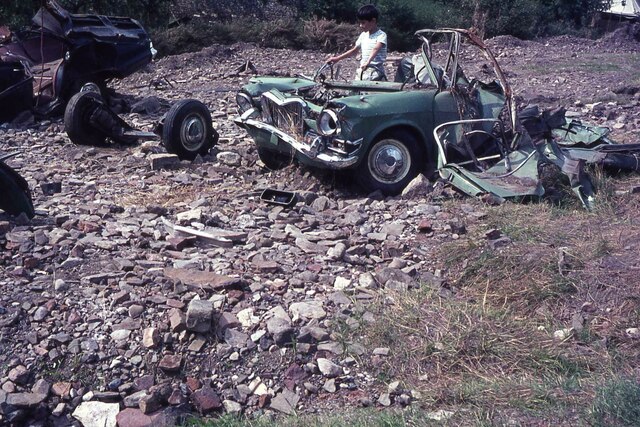
Image: © Richard Park Taken: Unknown
The devastating floods of July 1968 swepted away the A37 road bridge at Pensford but the older bridge in the centre of the village survived. The Army were soon involved with building a Bailey Bridge to span the River Chew. This is all that were left of cars that were swept away by the flood and deposited here. The information is documented on the following link;- https://en.wikipedia.org/wiki/Chew_Stoke_flood_of_1968
Images are licensed for reuse under creativecommons.org/licenses/by-sa/2.0
Image Location
Latitude
51.372327
Longitude
-2.549454