Tolpuddle houses [8]
Introduction
The photograph on this page of Tolpuddle houses [8] by Michael Dibb as part of the Geograph project.
The Geograph project started in 2005 with the aim of publishing, organising and preserving representative images for every square kilometre of Great Britain, Ireland and the Isle of Man.

There are currently over 7.5m images from over 14,400 individuals and you can help contribute to the project by visiting https://www.geograph.org.uk
Tolpuddle houses [8]
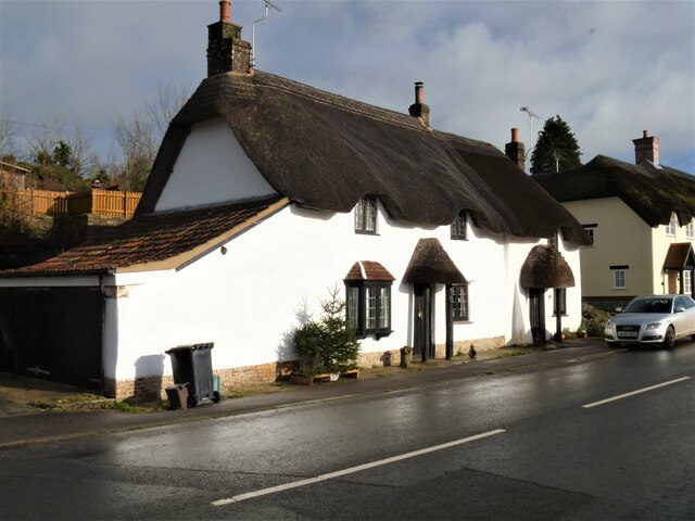
Image: © Michael Dibb Taken: 11 Dec 2020
Numbers 67 and 69 Main Road are probably 18th century. Built with plastered cob walls and a thatched roof. There are extensions on the left and at the rear. Listed, grade II, with details at: https://historicengland.org.uk/listing/the-list/list-entry/1155053 The village of Tolpuddle is located alongside the River Piddle is some 7 miles north east of Dorchester and is essentially a commuter village. Formerly astride the A35, the village is now by-passed. The village is renowned as the home of the Tolpuddle Martyrs, six farm labourers led by a Methodist lay preacher who met to form a union to resist reductions in wages.
Images are licensed for reuse under creativecommons.org/licenses/by-sa/2.0
Image Location
Latitude
50.748749
Longitude
-2.290664