
Lower Writhlington Colliery from the north east
Introduction
The photograph on this page of Lower Writhlington Colliery from the north east by Martin Tester as part of the Geograph project.
The Geograph project started in 2005 with the aim of publishing, organising and preserving representative images for every square kilometre of Great Britain, Ireland and the Isle of Man.

There are currently over 7.5m images from over 14,400 individuals and you can help contribute to the project by visiting https://www.geograph.org.uk
Lower Writhlington Colliery from the north east
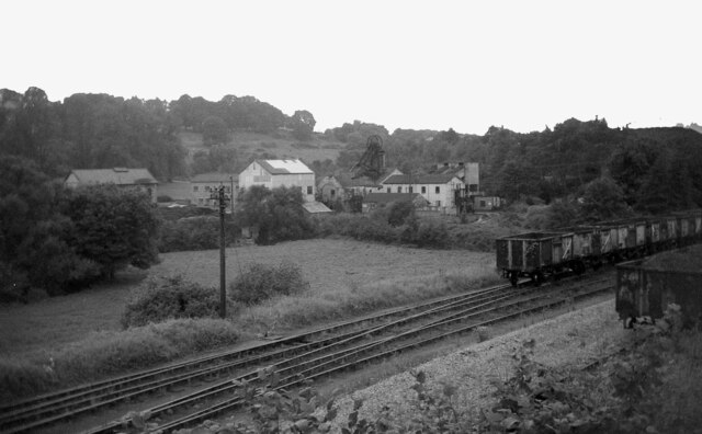
Image: © Martin Tester Taken: 4 Sep 1968
Opened in 1829 Lower Writhlington Colliery lasted until September 1973, when it (& the nearby Kilmersdon Colliery) closed thus ending coal production in Somerset. The railway lines in the foreground are part of the short length of the Somerset & Dorset line that remained in place to allow the coal to be taken away. For a view from across the valley see Image I am grateful to Simon Carter of the Radstock Museum (http://radstockmuseum.co.uk/ ) for help in identifying this location.
Images are licensed for reuse under creativecommons.org/licenses/by-sa/2.0
Image Location

Latitude
51.296319
Longitude
-2.424125