The Westlink, Belfast (10)
Introduction
The photograph on this page of The Westlink, Belfast (10) by Albert Bridge as part of the Geograph project.
The Geograph project started in 2005 with the aim of publishing, organising and preserving representative images for every square kilometre of Great Britain, Ireland and the Isle of Man.

There are currently over 7.5m images from over 14,400 individuals and you can help contribute to the project by visiting https://www.geograph.org.uk
The Westlink, Belfast (10)
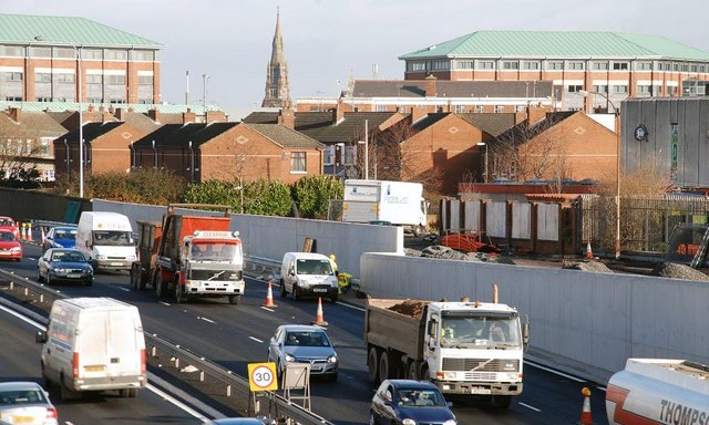
Image: © Albert Bridge Taken: 4 Feb 2008
See Image There is no southbound exit from the Westlink to the Grosvenor Road (and the city centre) here mainly because of the proximity of the houses in the background. The view is towards the M2.
Images are licensed for reuse under creativecommons.org/licenses/by-sa/2.0
Image Location
Latitude
54.596083
Longitude
-5.941741