Old Railway Infrastructure, Radcliffe North Junction
Introduction
The photograph on this page of Old Railway Infrastructure, Radcliffe North Junction by David Dixon as part of the Geograph project.
The Geograph project started in 2005 with the aim of publishing, organising and preserving representative images for every square kilometre of Great Britain, Ireland and the Isle of Man.

There are currently over 7.5m images from over 14,400 individuals and you can help contribute to the project by visiting https://www.geograph.org.uk
Old Railway Infrastructure, Radcliffe North Junction
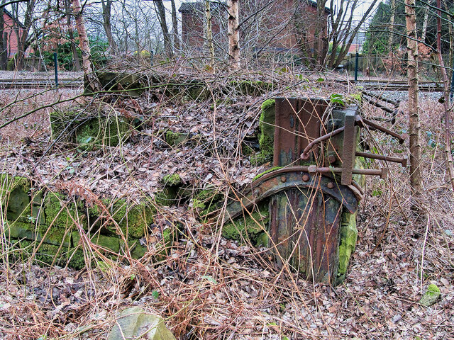
Image: © David Dixon Taken: 3 Mar 2021
This structure, made from stone reinforced with iron, is slightly to the north of the overgrown railway track seen in Image OS maps from the late 19th and early 20th century (eg https://bit.ly/3v4zQ2Q ) show that there was a siding here (possibly connected with the Withins Cotton Mill). This structure may have been the buffer stop.
Images are licensed for reuse under creativecommons.org/licenses/by-sa/2.0
Image Location
Latitude
53.567642
Longitude
-2.319612