Iwerne Minster houses [12]
Introduction
The photograph on this page of Iwerne Minster houses [12] by Michael Dibb as part of the Geograph project.
The Geograph project started in 2005 with the aim of publishing, organising and preserving representative images for every square kilometre of Great Britain, Ireland and the Isle of Man.

There are currently over 7.5m images from over 14,400 individuals and you can help contribute to the project by visiting https://www.geograph.org.uk
Iwerne Minster houses [12]
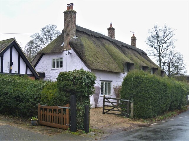
Image: © Michael Dibb Taken: 10 Dec 2020
The Old Cottage in Higher Street is a hall house of the early 16th century with the hall floored in the 17th century. There have been alterations in the 18th, 19th and 20th centuries. At one time it was converted into two cottages now reverted to one. Built in a mixture of flint rubble stone and brick with a thatched roof which is supported on four true cruck trusses. Listed, grade II, with details at: https://historicengland.org.uk/listing/the-list/list-entry/1324637 Iwerne Minster is a small village on the edge of the Blackmore Vale, about 5 miles south of Shaftesbury and the same distance north of Blandford Forum. The village is within the Cranborne Chase and West Wiltshire Down Area of Outstanding Natural Beauty. There is evidence of occupation since prehistoric times. The River Iwerne flows from a spring in the middle of the village. The original Minister is now St Mary's Church and was built by the Normans on the site of an earlier church.
Images are licensed for reuse under creativecommons.org/licenses/by-sa/2.0
Image Location
Latitude
50.929792
Longitude
-2.192471