Iwerne Minster features [4]
Introduction
The photograph on this page of Iwerne Minster features [4] by Michael Dibb as part of the Geograph project.
The Geograph project started in 2005 with the aim of publishing, organising and preserving representative images for every square kilometre of Great Britain, Ireland and the Isle of Man.

There are currently over 7.5m images from over 14,400 individuals and you can help contribute to the project by visiting https://www.geograph.org.uk
Iwerne Minster features [4]
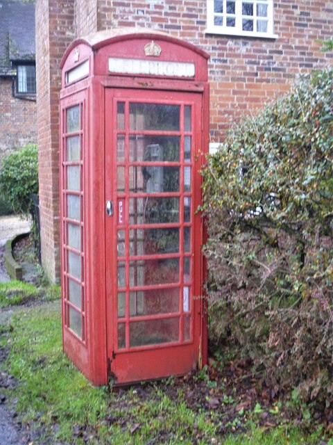
Image: © Michael Dibb Taken: 10 Dec 2020
A K6 telephone box, designed in 1935 by Sir Giles Gilbert Scott. Listed, grade II, with details at: https://historicengland.org.uk/listing/the-list/list-entry/1393233 Iwerne Minster is a small village on the edge of the Blackmore Vale, about 5 miles south of Shaftesbury and the same distance north of Blandford Forum. The village is within the Cranborne Chase and West Wiltshire Down Area of Outstanding Natural Beauty. There is evidence of occupation since prehistoric times. The River Iwerne flows from a spring in the middle of the village. The original Minister is now St Mary's Church and was built by the Normans on the site of an earlier church.
Images are licensed for reuse under creativecommons.org/licenses/by-sa/2.0
Image Location


Leaflet Map data © OpenStreetMap
Latitude
50.928086
Longitude
-2.190757