Development site off Northgate
Introduction
The photograph on this page of Development site off Northgate by Jonathan Thacker as part of the Geograph project.
The Geograph project started in 2005 with the aim of publishing, organising and preserving representative images for every square kilometre of Great Britain, Ireland and the Isle of Man.

There are currently over 7.5m images from over 14,400 individuals and you can help contribute to the project by visiting https://www.geograph.org.uk
Development site off Northgate
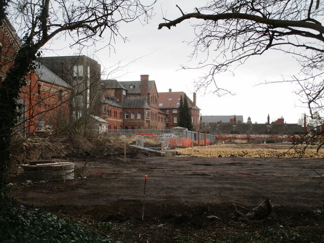
Image: © Jonathan Thacker Taken: 23 Feb 2021
This large site has been derelict for a couple of decades but now work is underway to bring it back into use. The original plans were for residential use but it seems that it is now to become a retail park. The buildings on the left are mostly part of the former Warwicks and Richardsons brewery https://historicengland.org.uk/listing/the-list/list-entry/1277425 The building closest to the camera are a former maltings dating from 1864 https://historicengland.org.uk/listing/the-list/list-entry/1196413 Such buildings lined the Newark branch of the River Trent but few now remain and this one is the only one remaining in near original condition.
Images are licensed for reuse under creativecommons.org/licenses/by-sa/2.0
Image Location


Leaflet Map data © OpenStreetMap
Latitude
53.081819
Longitude
-0.806093