72 and 74 Doods Road
Introduction
The photograph on this page of 72 and 74 Doods Road by Ian Capper as part of the Geograph project.
The Geograph project started in 2005 with the aim of publishing, organising and preserving representative images for every square kilometre of Great Britain, Ireland and the Isle of Man.

There are currently over 7.5m images from over 14,400 individuals and you can help contribute to the project by visiting https://www.geograph.org.uk
72 and 74 Doods Road
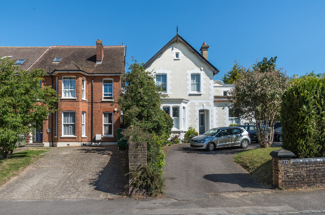
Image: © Ian Capper Taken: 15 May 2020
Large Victorian houses in Doods Road. No 72, on the left, is one of a pair of semi-detached houses (other than the roof, its partner, no. 70, is not visible in this photo). No 74, on the right, named Doods Brow, was for many years occupied by a school of that name until it moved to Nutfield to utilise the former village school there (see Image).
Images are licensed for reuse under creativecommons.org/licenses/by-sa/2.0
Image Location
Latitude
51.24098
Longitude
-0.192373