
Livingston East Electricity Distribution Station
Introduction
The photograph on this page of Livingston East Electricity Distribution Station by Ian Dodds as part of the Geograph project.
The Geograph project started in 2005 with the aim of publishing, organising and preserving representative images for every square kilometre of Great Britain, Ireland and the Isle of Man.

There are currently over 7.5m images from over 14,400 individuals and you can help contribute to the project by visiting https://www.geograph.org.uk
Livingston East Electricity Distribution Station
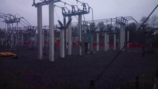
Image: © Ian Dodds Taken: 23 Feb 2021
Taken by holding camera (very tightly!) inside the railings. I am often frustrated by the lack of readily available information about our utilities infrastructure. No doubt this is on the basis that it would facilitate some kind of terrorism. However, due to the fact that these sites, and the overhead powerlines that supply them, are hardly subtle, I don't really have much truck with this argument. There is an overhead powerline that stops about half a mile East of here on the outskirts of Mid Calder. Presumably the cables then go underground into here. From what I can gather, these electricity stations lower the voltage carried by the overhead lines, then feed into the smaller electricity substations found fenced or bricked off in housing estates and business premises, which then lower the voltage again. The outbound voltage from this one is 33kV, which is on the high side for a distribution station according to Wikipedia. I only know this as there was a one of those statutory notices affixed to the entrance gates stating that modifications to the site would be taking place. And possibly already have, as the notice was from a year or two back. Rather like election advertising boards and birthday banners, nobody who puts these notices up seems responsible for taking them down!
Images are licensed for reuse under creativecommons.org/licenses/by-sa/2.0
Image Location

Latitude
55.882579
Longitude
-3.493037