Tamar side valley to St Mellion
Introduction
The photograph on this page of Tamar side valley to St Mellion by Trevor Rickard as part of the Geograph project.
The Geograph project started in 2005 with the aim of publishing, organising and preserving representative images for every square kilometre of Great Britain, Ireland and the Isle of Man.

There are currently over 7.5m images from over 14,400 individuals and you can help contribute to the project by visiting https://www.geograph.org.uk
Tamar side valley to St Mellion
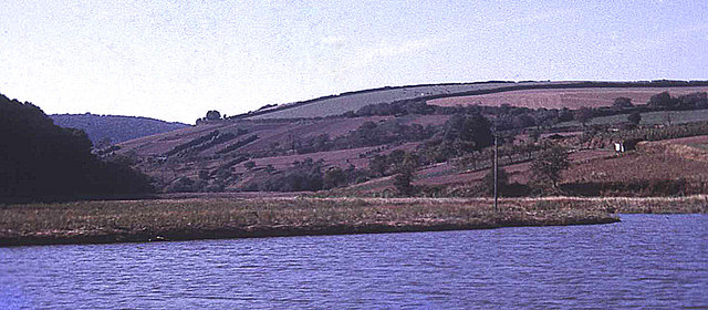
Image: © Trevor Rickard Taken: Unknown
View westwards from the river up the small side stream towards St Mellion. Typical of sunken estuaries, this very small stream has a relatively large valley, which is tidal for a mile from here. Strawberry Hill to the right and Hornifast Wood to the left. Ahead is some prime steep south-facing Tamar valley market gardening land - here still active in 1971, but today mostly reverted to scrub and farmland. This rural setting was not so tranquil in the war... http://www.bbc.co.uk/ww2peopleswar/stories/89/a5726289.shtml
Images are licensed for reuse under creativecommons.org/licenses/by-sa/2.0
Image Location


Leaflet Map data © OpenStreetMap
Latitude
50.465032
Longitude
-4.240828