Boyton village sign
Introduction
The photograph on this page of Boyton village sign by Adrian S Pye as part of the Geograph project.
The Geograph project started in 2005 with the aim of publishing, organising and preserving representative images for every square kilometre of Great Britain, Ireland and the Isle of Man.

There are currently over 7.5m images from over 14,400 individuals and you can help contribute to the project by visiting https://www.geograph.org.uk
Boyton village sign
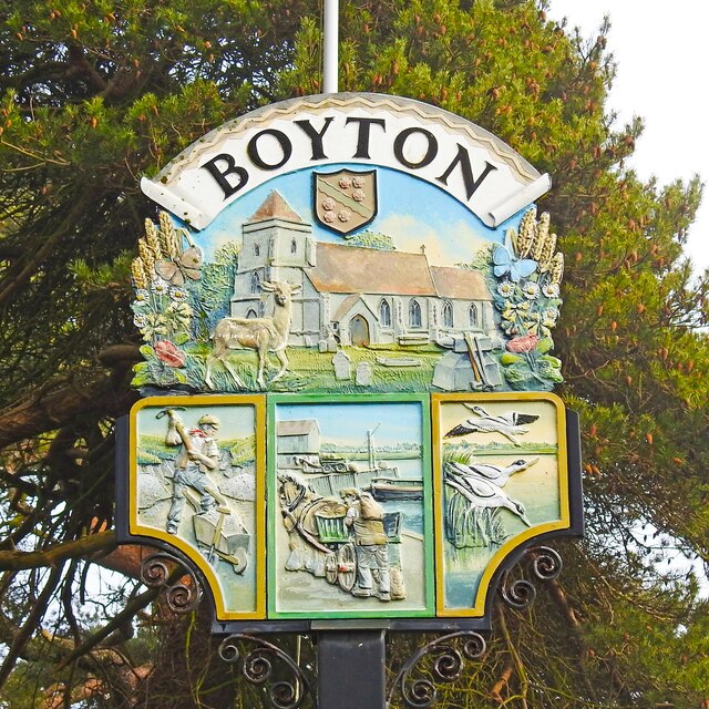
Image: © Adrian S Pye Taken: 4 Feb 2021
The sign is stuffed full of details about the village; immediately below the name is the crest of the Warner family which relates in particular to Miss Mary Warner, heiress and wealthy benefactor. Mary Warner had almshouses built “intended for six poor men and six poor women.” Four new apartments were added in 1835 and four more in 1847. The church of St Andrew, a fallow deer, with various other flora and fauna hinting at the agricultural heritage of the parish which are accompanied by a blacksmith’s anvil and tools. Below the main illustration are three more, the first depicts a man digging chalk from the cliffs. The second, located at Woodbridge docks indicates the trading of commodities which went on, and the third shows avocets which are commonly seen on Boyton marshes. https://www.geograph.org.uk/photo/4291313
Images are licensed for reuse under creativecommons.org/licenses/by-sa/2.0
Image Location
Latitude
52.07163
Longitude
1.46817