Abandoned stretch of Wyrley & Essington Canal, 1986
Introduction
The photograph on this page of Abandoned stretch of Wyrley & Essington Canal, 1986 by Trevor Littlewood as part of the Geograph project.
The Geograph project started in 2005 with the aim of publishing, organising and preserving representative images for every square kilometre of Great Britain, Ireland and the Isle of Man.

There are currently over 7.5m images from over 14,400 individuals and you can help contribute to the project by visiting https://www.geograph.org.uk
Abandoned stretch of Wyrley & Essington Canal, 1986
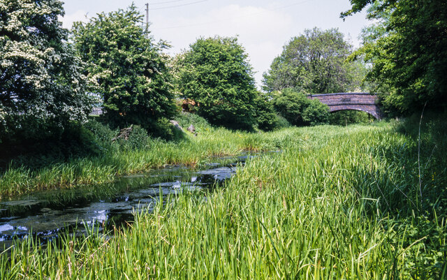
Image: © Trevor Littlewood Taken: 14 Jun 1986
An overgrown part of the canal heading towards Baker Bridge in the Upper Landywood area, south of Great Wyrley. The location from which the image was recorded appears now, (2021), to be under or at least close to an industrial site concerning gas.
Images are licensed for reuse under creativecommons.org/licenses/by-sa/2.0
Image Location
Latitude
52.644985
Longitude
-2.028629