Old guidestone
Introduction
The photograph on this page of Old guidestone by Robert Glover as part of the Geograph project.
The Geograph project started in 2005 with the aim of publishing, organising and preserving representative images for every square kilometre of Great Britain, Ireland and the Isle of Man.

There are currently over 7.5m images from over 14,400 individuals and you can help contribute to the project by visiting https://www.geograph.org.uk
Old guidestone
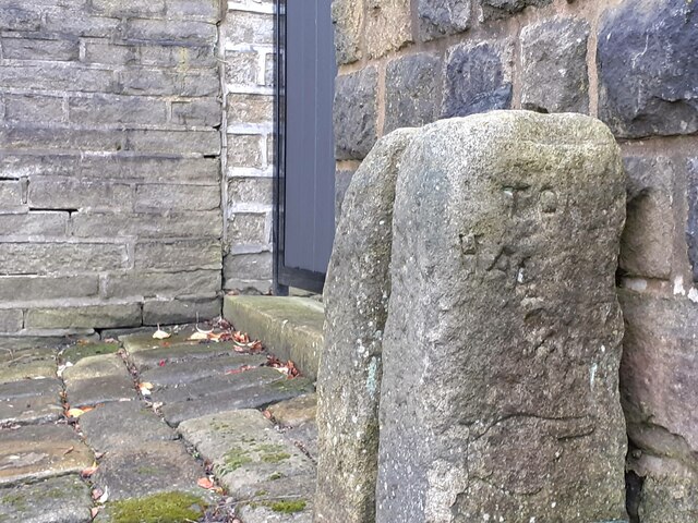
Image: © Robert Glover Taken: 16 Nov 2020
This stone was once part of the village stocks. The slot shows on the front of the stone. It is on the Calderdale Way footpath off Northfield Terrace. The eroded legend is TO/HARWORTH/ hand pointing right. A plate at the base of the stone says, 'Stocks originally in Towngate. Removed in 19th century to a site in front of present Stocks Villa, finally taken down in 1875'. Grade II listed.
Images are licensed for reuse under creativecommons.org/licenses/by-sa/2.0
Image Location
Latitude
53.750168
Longitude
-2.020132