Clare houses [31]
Introduction
The photograph on this page of Clare houses [31] by Michael Dibb as part of the Geograph project.
The Geograph project started in 2005 with the aim of publishing, organising and preserving representative images for every square kilometre of Great Britain, Ireland and the Isle of Man.

There are currently over 7.5m images from over 14,400 individuals and you can help contribute to the project by visiting https://www.geograph.org.uk
Clare houses [31]
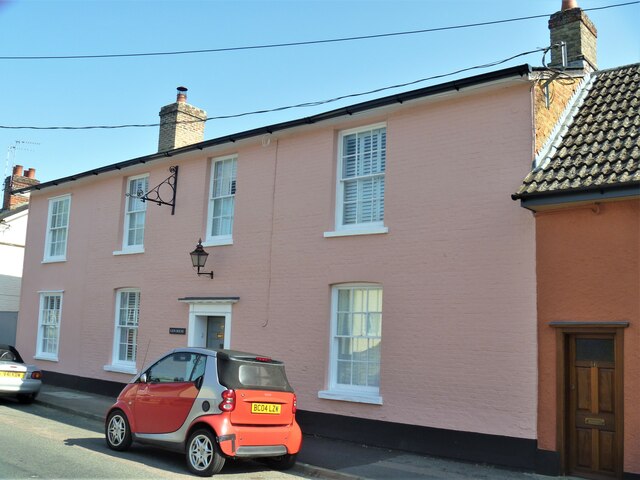
Image: © Michael Dibb Taken: 14 Sep 2020
This large house, number 45 Bridewell Street, was formerly the Red Lion Inn, known earlier as The Lion. The inn opened in the 17th century and closed in 1982. Built in the 17th century, timber framed and plastered, refronted, mostly in brick, in the 19th century. Listed, grade II, with details at: https://historicengland.org.uk/listing/the-list/list-entry/1031769 The market town of Clare is Suffolk’s smallest town. It lies on the north bank of the River Stour some 12 miles south of Bury St Edmunds and some 7 miles west of Sudbury. Remains of every period since the Palaeolithic have been found in the area. There is a Norman castle, a 13th century Augustinian Priory and a fine, medieval ‘wool’ church as well as many listed buildings, some of which date to the 16th century or earlier.
Images are licensed for reuse under creativecommons.org/licenses/by-sa/2.0
Image Location
Latitude
52.082073
Longitude
0.581871