Old Boundary Marker on the B5058 Abbey Lane, Sheffield
Introduction
The photograph on this page of Old Boundary Marker on the B5058 Abbey Lane, Sheffield by C Brash as part of the Geograph project.
The Geograph project started in 2005 with the aim of publishing, organising and preserving representative images for every square kilometre of Great Britain, Ireland and the Isle of Man.

There are currently over 7.5m images from over 14,400 individuals and you can help contribute to the project by visiting https://www.geograph.org.uk
Old Boundary Marker on the B5058 Abbey Lane, Sheffield
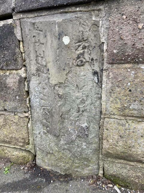
Image: © C Brash Taken: 14 Feb 2021
Parish Boundary Marker set in the front garden wall of a semi-detached house on the northwest side of the B6068 Abbey Lane, Sheffield. Inscribed BEAUCHIEFE and NORTON both vertically. On the former boundary of Beauchief and Norton parishes, probably erected after 1858 when Beauchief civil parish was created, and when both parishes were in Derbyshire. Milestone Society National ID: YW_SHF05pb
Images are licensed for reuse under creativecommons.org/licenses/by-sa/2.0
Image Location
Latitude
53.3385
Longitude
-1.487256