Old milestone, Doncaster Road, High Melton
Introduction
The photograph on this page of Old milestone, Doncaster Road, High Melton by Chris Minto as part of the Geograph project.
The Geograph project started in 2005 with the aim of publishing, organising and preserving representative images for every square kilometre of Great Britain, Ireland and the Isle of Man.

There are currently over 7.5m images from over 14,400 individuals and you can help contribute to the project by visiting https://www.geograph.org.uk
Old milestone, Doncaster Road, High Melton
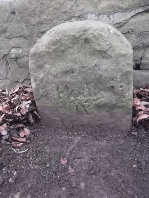
Image: © Chris Minto Taken: 5 Jan 2019
At the east end of High Melton on the unclassified road between Sprotbrough and Barnburgh. For 40 years it was seen with only the top few inches showing. After roadworks it was reset although it is broken just below present ground level. Part of the legend 'From/Wentworth' has eroded away Houſe also has its e missing. From the 1720s Thomas Watson-Wentworth, later 1st Marquis of Rockingham, had miles marked on the various routes from Wentworth, sometimes on trees, building or convenient stones. From 1750 he had stones set up. This one is on his route to the Great North Road north of Doncaster.
Images are licensed for reuse under creativecommons.org/licenses/by-sa/2.0
Image Location
Latitude
53.512034
Longitude
-1.232112