Old Boundary Marker at Samuel's Corner
Introduction
The photograph on this page of Old Boundary Marker at Samuel's Corner by L Chinea as part of the Geograph project.
The Geograph project started in 2005 with the aim of publishing, organising and preserving representative images for every square kilometre of Great Britain, Ireland and the Isle of Man.

There are currently over 7.5m images from over 14,400 individuals and you can help contribute to the project by visiting https://www.geograph.org.uk
Old Boundary Marker at Samuel's Corner
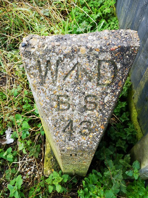
Image: © L Chinea Taken: 4 Feb 2021
War Department Boundary Marker on the south side of New Road / Stairs Road at Samuel's Corner against a front garden fence. Great Wakering parish. Inscribed W ↑ D / B S / 43 on its top face and 14FT IN (FRONT?) across its front below this. On the boundary of Shoeburyness New Ranges. Milestone Society National ID: EX_WDWAK43em
Images are licensed for reuse under creativecommons.org/licenses/by-sa/2.0
Image Location
Latitude
51.551733
Longitude
0.8226