Long Melford buildings [53]
Introduction
The photograph on this page of Long Melford buildings [53] by Michael Dibb as part of the Geograph project.
The Geograph project started in 2005 with the aim of publishing, organising and preserving representative images for every square kilometre of Great Britain, Ireland and the Isle of Man.

There are currently over 7.5m images from over 14,400 individuals and you can help contribute to the project by visiting https://www.geograph.org.uk
Long Melford buildings [53]
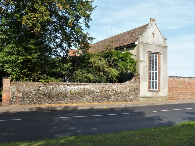
Image: © Michael Dibb Taken: 13 Sep 2020
This chapel is the only remaining part of Melford Place. The original house was demolished early in the 19th century and replaced by another house which was destroyed by fire in 1967. However, the 14th century private chapel with its fine timber roof survived, as did the excellent Renaissance style carvings. The much altered exterior is gabled to the street and is now incorporated into the new house built on the site. Listed, grade II*, with details at: https://historicengland.org.uk/listing/the-list/list-entry/1183356 Long Melford is a large village in Suffolk near the border with Essex, some 3 miles north of Sudbury. The village gained its name because it stretches for two and three quarter miles essentially along a single road. There is evidence of occupation from every period from the Mesolithic. The village contains two stately homes, Kentwell Hall and Melford Hall, is home to one of the largest and richest "wool churches" in East Anglia with fine flushwork, and a superb almshouse founded in 1573.
Images are licensed for reuse under creativecommons.org/licenses/by-sa/2.0
Image Location
Latitude
52.071607
Longitude
0.715378