Old Milestone, on the A629,
Introduction
The photograph on this page of Old Milestone, on the A629, by Christine Minto as part of the Geograph project.
The Geograph project started in 2005 with the aim of publishing, organising and preserving representative images for every square kilometre of Great Britain, Ireland and the Isle of Man.

There are currently over 7.5m images from over 14,400 individuals and you can help contribute to the project by visiting https://www.geograph.org.uk
Old Milestone, on the A629,
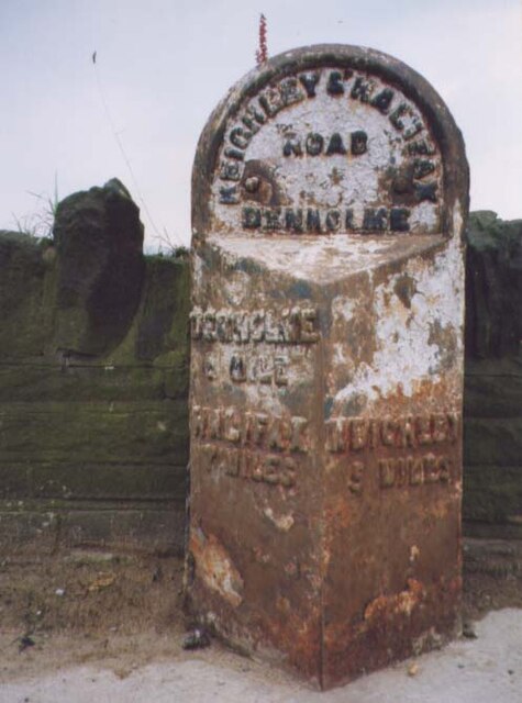
Image: © Christine Minto Taken: 31 Dec 2005
N of Denholme, opposite houses called Sunnydale. Located on the East side of road, on narrow pavement. Metal plate attached to stone post, WR casting design, erected by Keighley & Halifax turnpike trust, 19th century. Alternative view see https://www.geograph.org.uk/photo/840534 Inscription reads: DENHOLME / ½ MILE / HALIFAX / 7 MILES // KEIGHLEY / 5 MILES // KEIGHLEY & HALIFAX / ROAD / DENHOLME Grade II listed by Historic England. see https://historicengland.org.uk/listing/the-list/list-entry/1314155 Milestone Society National ID: YW_KEHA05
Images are licensed for reuse under creativecommons.org/licenses/by-sa/2.0
Image Location
Latitude
53.807648
Longitude
-1.896551