Worcester Road (Leominster)
Introduction
The photograph on this page of Worcester Road (Leominster) by Fabian Musto as part of the Geograph project.
The Geograph project started in 2005 with the aim of publishing, organising and preserving representative images for every square kilometre of Great Britain, Ireland and the Isle of Man.

There are currently over 7.5m images from over 14,400 individuals and you can help contribute to the project by visiting https://www.geograph.org.uk
Worcester Road (Leominster)
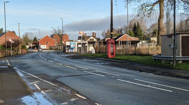
Image: © Fabian Musto Taken: 3 Feb 2021
The tall brick towers in the distance are part of Pinsley Mill Gardens, a housing development built on the site of one of the world's earliest cotton mills. To the right of it is the White Lion pub, then the railway station sign for Leominster can be seen in front, and closer to the camera to the right is an active K6 telephone box.
Images are licensed for reuse under creativecommons.org/licenses/by-sa/2.0
Image Location
Latitude
52.224865
Longitude
-2.731352