Old milestone
Introduction
The photograph on this page of Old milestone by Chris Minto as part of the Geograph project.
The Geograph project started in 2005 with the aim of publishing, organising and preserving representative images for every square kilometre of Great Britain, Ireland and the Isle of Man.

There are currently over 7.5m images from over 14,400 individuals and you can help contribute to the project by visiting https://www.geograph.org.uk
Old milestone
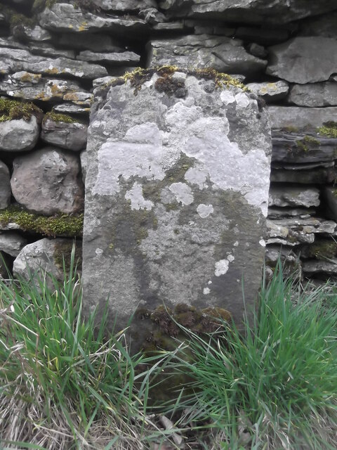
Image: © Chris Minto Taken: 8 Apr 2019
On the north side of the unclassified road north of the River Ure at Woodall between Carperby and Askrigg. There is a 16, the mileage to Richmond, inscribed near the top covered in white lichens which are indicative of the clean air. The stone may date from the 18C on the 1751 Lancaster to Richmond turnpike. One other remaining stone on this section of road is the same shape.
Images are licensed for reuse under creativecommons.org/licenses/by-sa/2.0
Image Location
Latitude
54.308384
Longitude
-2.038235