Cassillis Road, Maybole, 1974
Introduction
The photograph on this page of Cassillis Road, Maybole, 1974 by Mary and Angus Hogg as part of the Geograph project.
The Geograph project started in 2005 with the aim of publishing, organising and preserving representative images for every square kilometre of Great Britain, Ireland and the Isle of Man.

There are currently over 7.5m images from over 14,400 individuals and you can help contribute to the project by visiting https://www.geograph.org.uk
Cassillis Road, Maybole, 1974
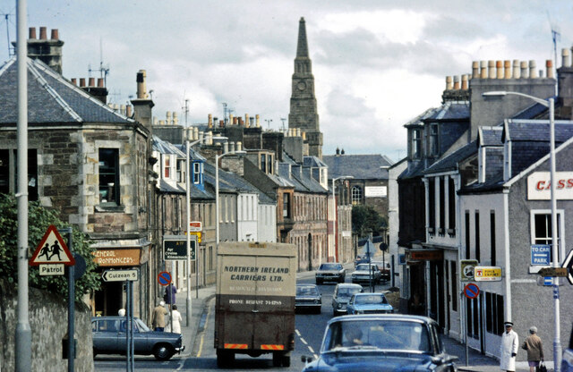
Image: © Mary and Angus Hogg Taken: Unknown
This shot shows a busy route centre in Maybole but with vehicles sufficiently small to keep moving. See Image for a 2019 view. The junction shown here is known as McQuiston's Corner, named after the ironmonger's shop which is shown here, open for business, on the left.
Images are licensed for reuse under creativecommons.org/licenses/by-sa/2.0
Image Location
Latitude
55.355581
Longitude
-4.679508