
Exchange Cottage, off The Glebe, Kirkliston
Introduction
The photograph on this page of Exchange Cottage, off The Glebe, Kirkliston by Ian Dodds as part of the Geograph project.
The Geograph project started in 2005 with the aim of publishing, organising and preserving representative images for every square kilometre of Great Britain, Ireland and the Isle of Man.

There are currently over 7.5m images from over 14,400 individuals and you can help contribute to the project by visiting https://www.geograph.org.uk
Exchange Cottage, off The Glebe, Kirkliston
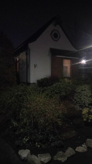
Image: © Ian Dodds Taken: 27 Jan 2021
Just off a footpath leading from Main Street to the council house road of The Glebe, this house sticks out a bit as so different from all the rest of the houses. I'm glad I found its name online as was wondering what on earth the building used to be used for. It is not present on the 1890s map and first appears on a 1914-surveyed OS map. Looks as though it was still in use as a telephone exchange on a map of the late 1960s.
Images are licensed for reuse under creativecommons.org/licenses/by-sa/2.0
Image Location

Latitude
55.955507
Longitude
-3.404547