Junction Mill chimney, Ashton-under-Lyne
Introduction
The photograph on this page of Junction Mill chimney, Ashton-under-Lyne by Chris Allen as part of the Geograph project.
The Geograph project started in 2005 with the aim of publishing, organising and preserving representative images for every square kilometre of Great Britain, Ireland and the Isle of Man.

There are currently over 7.5m images from over 14,400 individuals and you can help contribute to the project by visiting https://www.geograph.org.uk
Junction Mill chimney, Ashton-under-Lyne
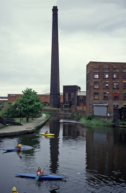
Image: © Chris Allen Taken: 15 May 1994
This spectacular chimney still survives but the tall engine house next to it has been demolished. The canal is the Ashton Canal and the Peak Forest Canal leaves to the left out of sight. To the right is Portland Basin
Images are licensed for reuse under creativecommons.org/licenses/by-sa/2.0
Image Location
Latitude
53.481738
Longitude
-2.101524