Old Milestone, on an unclassified road (was A162), Milford Road N end of South Milford
Introduction
The photograph on this page of Old Milestone, on an unclassified road (was A162), Milford Road N end of South Milford by Christine Minto as part of the Geograph project.
The Geograph project started in 2005 with the aim of publishing, organising and preserving representative images for every square kilometre of Great Britain, Ireland and the Isle of Man.

There are currently over 7.5m images from over 14,400 individuals and you can help contribute to the project by visiting https://www.geograph.org.uk
Old Milestone, on an unclassified road (was A162), Milford Road N end of South Milford
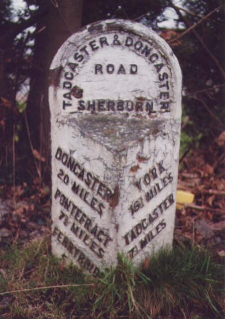
Image: © Christine Minto Taken: 27 Dec 2005
S of railway bridge. Located on the West side of road, In front of wall of Milford House . Metal plate attached to stone post, Brayshaw & Booth casting design, 19th century. Inscription reads: DONCASTER / 20 MILES / PONTEFRACT / 7¾ MILES / FERRYBRIDGE / 5 MILES // YORK / 16¾ MILES / TADCASTER / 7¼ MILES // TADCASTER & DONCASTER / ROAD / SHERBURN // BRAYSHAW & BOOTH / MAKERS / LIVERSEDGE Milestone Society National ID: YN_DNTC20
Images are licensed for reuse under creativecommons.org/licenses/by-sa/2.0
Image Location
Latitude
53.780798
Longitude
-1.247855