Innellan Post Office
Introduction
The photograph on this page of Innellan Post Office by Thomas Nugent as part of the Geograph project.
The Geograph project started in 2005 with the aim of publishing, organising and preserving representative images for every square kilometre of Great Britain, Ireland and the Isle of Man.

There are currently over 7.5m images from over 14,400 individuals and you can help contribute to the project by visiting https://www.geograph.org.uk
Innellan Post Office
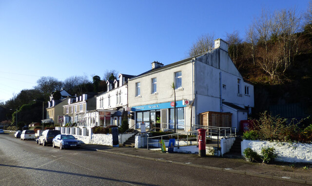
Image: © Thomas Nugent Taken: 4 Jan 2021
The Post Office is located within The Lido community owned shop. An Early Day Motion in the UK Parliament on 28th January 2020 referred to the community effort to reopen the shop and post office... "That this House congratulates South Cowal Community Enterprise and all the residents of the villages of Toward and Innellan on the South Cowal peninsular(sic) who, following a two-year campaign and with the assistance of the Scottish Land Fund saved their local village shop and Post Office, The Lido from closure; acknowledges the remarkable contribution from the people of Cowal who raised £68,000 through a community share offer which enabled the business to be transferred into community ownership; recognises the importance of local shops and Post Offices to the sustainability and viability of rural communities; wishes The Lido every success in the future; and hopes that other communities facing the loss of vital services will be inspired by what has been achieved by the South Cowal Community Development Company and people of Toward and Innellan and be encouraged to explore the option of community ownership." See the building in 2011 Image
Images are licensed for reuse under creativecommons.org/licenses/by-sa/2.0
Image Location
Latitude
55.896929
Longitude
-4.95254