47 and 49 Alma Road
Introduction
The photograph on this page of 47 and 49 Alma Road by Ian Capper as part of the Geograph project.
The Geograph project started in 2005 with the aim of publishing, organising and preserving representative images for every square kilometre of Great Britain, Ireland and the Isle of Man.

There are currently over 7.5m images from over 14,400 individuals and you can help contribute to the project by visiting https://www.geograph.org.uk
47 and 49 Alma Road
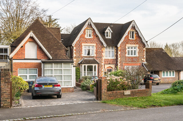
Image: © Ian Capper Taken: 7 Apr 2020
Houses on Alma Road. No 47 (The Copse), on the right, is mid 19th Century and locally listed. No 49 is later, a building first being shown on the site on the 1914 1,2500 map, possibly as a garage to the main house, which was presumably later converted.
Images are licensed for reuse under creativecommons.org/licenses/by-sa/2.0
Image Location
Latitude
51.247625
Longitude
-0.196984