Viaduct on Stour Valley Line, 1980
Introduction
The photograph on this page of Viaduct on Stour Valley Line, 1980 by Trevor Littlewood as part of the Geograph project.
The Geograph project started in 2005 with the aim of publishing, organising and preserving representative images for every square kilometre of Great Britain, Ireland and the Isle of Man.

There are currently over 7.5m images from over 14,400 individuals and you can help contribute to the project by visiting https://www.geograph.org.uk
Viaduct on Stour Valley Line, 1980
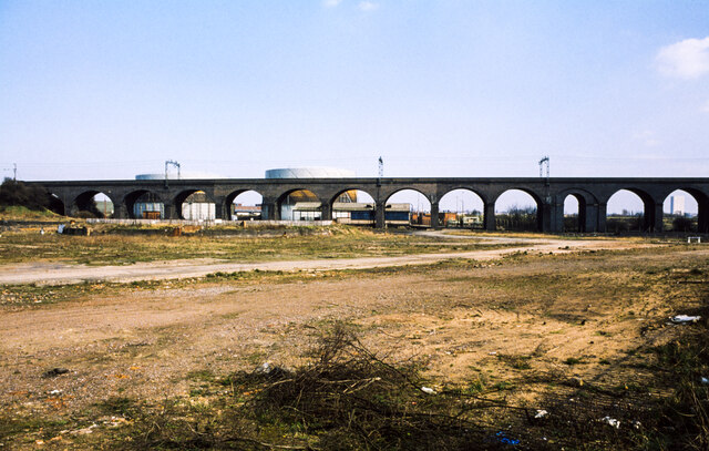
Image: © Trevor Littlewood Taken: 4 Apr 1980
The viaduct as seen from the tow path of the Birmingham Canal in the vicinity of locks 13 and 14 of the Wolverhampton flight. Notes made at the time, April 1980, record that the waste ground was the site of a gas works. Two gasometers can be seen beyond the arches of the viaduct and still seem to be in place over 40 years later. The site is now occupied by a science park.
Images are licensed for reuse under creativecommons.org/licenses/by-sa/2.0
Image Location
Latitude
52.601951
Longitude
-2.125607