Near Pevensey ? 1966
Introduction
The photograph on this page of Near Pevensey ? 1966 by Alan Murray-Rust as part of the Geograph project.
The Geograph project started in 2005 with the aim of publishing, organising and preserving representative images for every square kilometre of Great Britain, Ireland and the Isle of Man.

There are currently over 7.5m images from over 14,400 individuals and you can help contribute to the project by visiting https://www.geograph.org.uk
Near Pevensey ? 1966
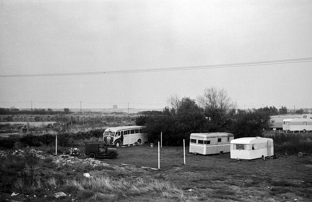
Image: © Alan Murray-Rust Taken: 11 Sep 1966
The view was taken, from a passing bus, to include the old bus, which has remained unidentified (except that it is a Dennis chassis). The main interest in the view is that it shows this section of the coast before the enormous Sovereign Harbour development arrived. The Martello Tower visible in the distance is No.65 at TQ 6470 0217.
Images are licensed for reuse under creativecommons.org/licenses/by-sa/2.0
Image Location
Latitude
50.794665
Longitude
0.319672