Old Boundary Marker on the south side of the A153
Introduction
The photograph on this page of Old Boundary Marker on the south side of the A153 by D Pitcher as part of the Geograph project.
The Geograph project started in 2005 with the aim of publishing, organising and preserving representative images for every square kilometre of Great Britain, Ireland and the Isle of Man.

There are currently over 7.5m images from over 14,400 individuals and you can help contribute to the project by visiting https://www.geograph.org.uk
Old Boundary Marker on the south side of the A153
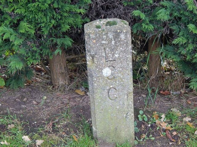
Image: © D Pitcher Taken: Unknown
Highway Authority boundary marker on the south side of the A153 Tumby Road. Coningsby parish. Inscribed L / C / C (Lindsey County Council). Milestone Society National ID: LI_CONING01pb
Images are licensed for reuse under creativecommons.org/licenses/by-sa/2.0
Image Location
Latitude
53.10997
Longitude
-0.161377