Main Street, Stretton under Fosse
Introduction
The photograph on this page of Main Street, Stretton under Fosse by Stephen McKay as part of the Geograph project.
The Geograph project started in 2005 with the aim of publishing, organising and preserving representative images for every square kilometre of Great Britain, Ireland and the Isle of Man.

There are currently over 7.5m images from over 14,400 individuals and you can help contribute to the project by visiting https://www.geograph.org.uk
Main Street, Stretton under Fosse
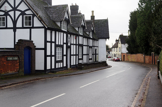
Image: © Stephen McKay Taken: 30 Dec 2020
Stretton under Fosse is not on the Fosse Way itself which is located about half a mile to the west. This is the view along Main Street with the grade II listed 16th century Home Farmhouse on the left.
Images are licensed for reuse under creativecommons.org/licenses/by-sa/2.0
Image Location
Latitude
52.429083
Longitude
-1.337102