37 - 41 Holywell Hill
Introduction
The photograph on this page of 37 - 41 Holywell Hill by Ian Capper as part of the Geograph project.
The Geograph project started in 2005 with the aim of publishing, organising and preserving representative images for every square kilometre of Great Britain, Ireland and the Isle of Man.

There are currently over 7.5m images from over 14,400 individuals and you can help contribute to the project by visiting https://www.geograph.org.uk
37 - 41 Holywell Hill
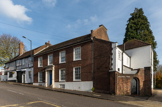
Image: © Ian Capper Taken: 13 Nov 2020
Group of buildings on Holywell Hill. No 37, on the far left, dates from the 15th Century and is Grade II* listed - see www.historicengland.org.uk/listing/the-list/list-entry/1103095. It was formerly the Crown and Anchor Inn - see Image for a photo of its Sopwell Lane aspect. Next is no 39, also 15th Century. Grade II listed - see www.historicengland.org.uk/listing/the-list/list-entry/1347143. The building in the centre of the photo is no 41, Holywell Lodge, 19th Century but possibly older. Also grade II listed - see www.historicengland.org.uk/listing/the-list/list-entry/1103096.
Images are licensed for reuse under creativecommons.org/licenses/by-sa/2.0
Image Location
Latitude
51.748889
Longitude
-0.340852