Yorke Gardens
Introduction
The photograph on this page of Yorke Gardens by Ian Capper as part of the Geograph project.
The Geograph project started in 2005 with the aim of publishing, organising and preserving representative images for every square kilometre of Great Britain, Ireland and the Isle of Man.

There are currently over 7.5m images from over 14,400 individuals and you can help contribute to the project by visiting https://www.geograph.org.uk
Yorke Gardens
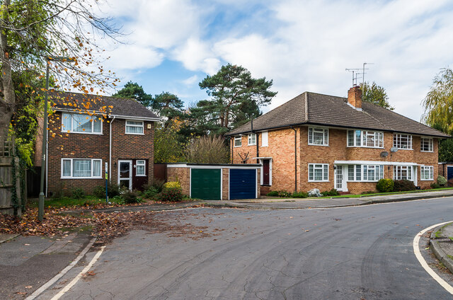
Image: © Ian Capper Taken: 6 Nov 2020
Cul-de-sac off Yorke Road built on the gardens of Wall House in Yorke Road and of 3 houses in London Road. It first appears on the 1970-6 1:1,250 map, compared with nothing on the 1963 edition. However, despite the majority of buildings now in the road being shown on the 1970-6 map, they are of three very different styles, suggesting that they were built in phases, possibly with the first stretch, that in the former garden of Wall House, slightly predating the rest of the road. Seen here is one of two blocks of maisonettes in the first section of the close, with part of one of the (slightly later?) blocks of townhouses beyond. The house on the left is one of the exceptions not shown on the 1970-6 map.
Images are licensed for reuse under creativecommons.org/licenses/by-sa/2.0
Image Location
Latitude
51.240867
Longitude
-0.208409