Water Markers
Introduction
The photograph on this page of Water Markers by Anne Burgess as part of the Geograph project.
The Geograph project started in 2005 with the aim of publishing, organising and preserving representative images for every square kilometre of Great Britain, Ireland and the Isle of Man.

There are currently over 7.5m images from over 14,400 individuals and you can help contribute to the project by visiting https://www.geograph.org.uk
Water Markers
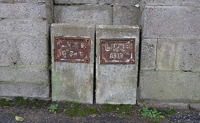
Image: © Anne Burgess Taken: 19 Dec 2020
I take it that LMWB stands for Laich of Moray Water Board, which ceased to exist when it was subsumed into the North-East of Scotland Water Board when the Water (Scotland) Act 1967 came into force.
Images are licensed for reuse under creativecommons.org/licenses/by-sa/2.0
Image Location
Latitude
57.700365
Longitude
-3.486034