Hotbank
Introduction
The photograph on this page of Hotbank by Andy Waddington as part of the Geograph project.
The Geograph project started in 2005 with the aim of publishing, organising and preserving representative images for every square kilometre of Great Britain, Ireland and the Isle of Man.

There are currently over 7.5m images from over 14,400 individuals and you can help contribute to the project by visiting https://www.geograph.org.uk
Hotbank
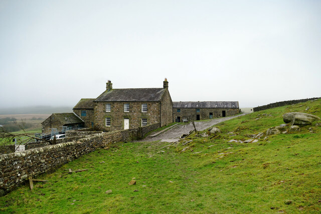
Image: © Andy Waddington Taken: 11 Dec 2020
Hotbank is a farmhouse in the shadow of Milecastle 38 of Hadrian's Wall (at least, its location would have been in the shadow when the wall was its original 4.5m height and the milecastle presumably rather bigger). There is a branch path heading past the buildings, but signage attempts to deter walkers from using it on the rather specious grounds of the risk of Coronavirus infection. That path wasn't on our route, so we were not affected but, come on, this is the outdoors, and no-one is going to hang around for fiteen minutes trying to get too close. Public rights of way may have been closed during foot and mouth, but that's a lot more infectious, and even our government haven't yet introduced cull and cremate as a control measure...
Images are licensed for reuse under creativecommons.org/licenses/by-sa/2.0
Image Location
Latitude
55.007656
Longitude
-2.357235