Former warehouses, Canning Street, Birkenhead
Introduction
The photograph on this page of Former warehouses, Canning Street, Birkenhead by Stephen Richards as part of the Geograph project.
The Geograph project started in 2005 with the aim of publishing, organising and preserving representative images for every square kilometre of Great Britain, Ireland and the Isle of Man.

There are currently over 7.5m images from over 14,400 individuals and you can help contribute to the project by visiting https://www.geograph.org.uk
Former warehouses, Canning Street, Birkenhead
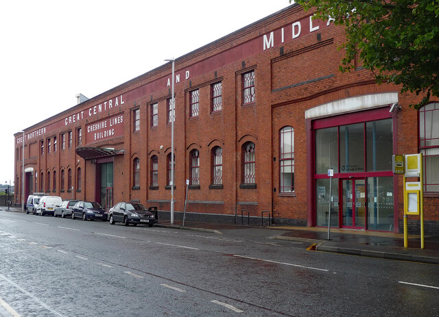
Image: © Stephen Richards Taken: 20 Aug 2014
Built for the Great Northern, Great Central and Midland Railway as the Shore Road Goods Station. Now known as the Cheshire Lines Building and housing the archives of Wirral Council.
Images are licensed for reuse under creativecommons.org/licenses/by-sa/2.0
Image Location
Latitude
53.395678
Longitude
-3.014004