Home Farm Road, Woodchurch ? 1966
Introduction
The photograph on this page of Home Farm Road, Woodchurch ? 1966 by Alan Murray-Rust as part of the Geograph project.
The Geograph project started in 2005 with the aim of publishing, organising and preserving representative images for every square kilometre of Great Britain, Ireland and the Isle of Man.

There are currently over 7.5m images from over 14,400 individuals and you can help contribute to the project by visiting https://www.geograph.org.uk
Home Farm Road, Woodchurch ? 1966
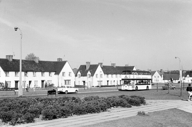
Image: © Alan Murray-Rust Taken: 14 May 1966
Woodchurch Estate was the first and largest of Birkenhead's post-WW2 housing estates, commenced in 1946, and designed with plenty of open space, particularly along the main arteries like Home Farm Road.
Images are licensed for reuse under creativecommons.org/licenses/by-sa/2.0
Image Location
Latitude
53.371214
Longitude
-3.077151