Mitton Street in Stourport, Worcestershire
Introduction
The photograph on this page of Mitton Street in Stourport, Worcestershire by Roger Kidd as part of the Geograph project.
The Geograph project started in 2005 with the aim of publishing, organising and preserving representative images for every square kilometre of Great Britain, Ireland and the Isle of Man.

There are currently over 7.5m images from over 14,400 individuals and you can help contribute to the project by visiting https://www.geograph.org.uk
Mitton Street in Stourport, Worcestershire
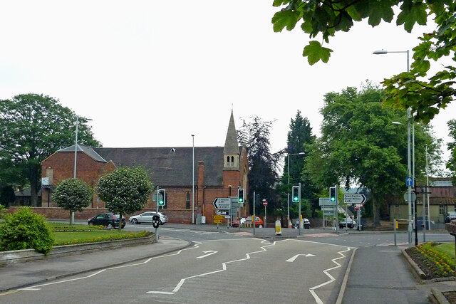
Image: © Roger Kidd Taken: 20 Jun 2013
Looking east across the junction with Vale Road and Lion Hill. The former Congregational Church dating from 1869-1870 is on the left. When the Congregational and Presbyterian churches combined it was re-named as the United Reformed Church. The URC congregation later merged with the Anglican congregation to worship at St Michael's Church so the building was used as St Wulstan's (RC) Community Centre. Closure, and plans to convert the building into living accommodation were published in 2016-2017.
Images are licensed for reuse under creativecommons.org/licenses/by-sa/2.0
Image Location
Latitude
52.340354
Longitude
-2.276777