Former Town Hall, Radcliffe
Introduction
The photograph on this page of Former Town Hall, Radcliffe by David Dixon as part of the Geograph project.
The Geograph project started in 2005 with the aim of publishing, organising and preserving representative images for every square kilometre of Great Britain, Ireland and the Isle of Man.

There are currently over 7.5m images from over 14,400 individuals and you can help contribute to the project by visiting https://www.geograph.org.uk
Former Town Hall, Radcliffe
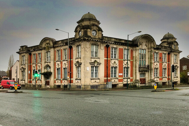
Image: © David Dixon Taken: 29 Nov 2020
The town hall was built in 1911 on the junction of Water Street and Spring Lane. It had a large council chamber with a public gallery on the first floor, along with four committee rooms; it formed the public administrative centre for the district for some time. Under the Local Government Act 1972, the town’s urban district status was abolished and in April 1974 Radcliffe became an unparished area of the Metropolitan Borough of Bury. The town hall stood empty for many years until, in 1999 after extensive renovation, the building was converted to self-contained one-bedroom flats of various sizes to provide private accommodation for 10 single homeless people.
Images are licensed for reuse under creativecommons.org/licenses/by-sa/2.0
Image Location
Latitude
53.562764
Longitude
-2.328482