Lower Clyde Valley
Introduction
The photograph on this page of Lower Clyde Valley by Nigel Mykura as part of the Geograph project.
The Geograph project started in 2005 with the aim of publishing, organising and preserving representative images for every square kilometre of Great Britain, Ireland and the Isle of Man.

There are currently over 7.5m images from over 14,400 individuals and you can help contribute to the project by visiting https://www.geograph.org.uk
Lower Clyde Valley
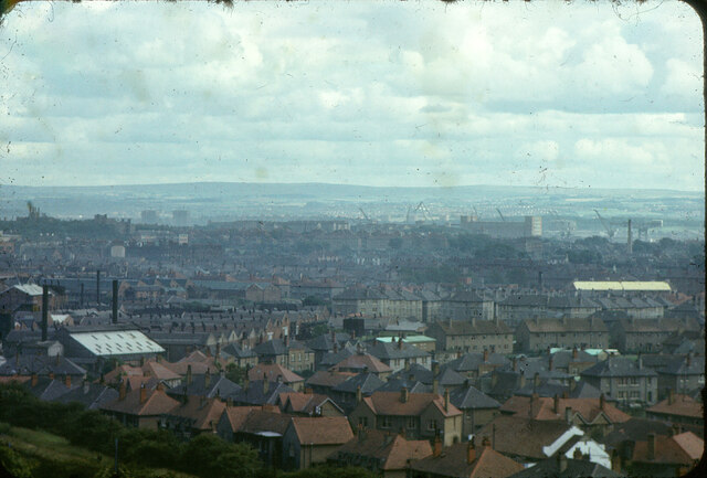
Image: © Nigel Mykura Taken: 19 Jul 2020
The houses in the foreground are in Glendinning Rd and in the lower left of the image is part of the tow path of the Forth and Clyde Canal. In the distance can be seen the (now demolished) Meadowside Granary at Whiteinch with the Barclay Curle Titan crane to the right of it. Thanks to Thomas Nugent for the information.
Images are licensed for reuse under creativecommons.org/licenses/by-sa/2.0
Image Location
Latitude
55.902239
Longitude
-4.332806