Former tollroad
Introduction
The photograph on this page of Former tollroad by Diana Burns as part of the Geograph project.
The Geograph project started in 2005 with the aim of publishing, organising and preserving representative images for every square kilometre of Great Britain, Ireland and the Isle of Man.

There are currently over 7.5m images from over 14,400 individuals and you can help contribute to the project by visiting https://www.geograph.org.uk
Former tollroad
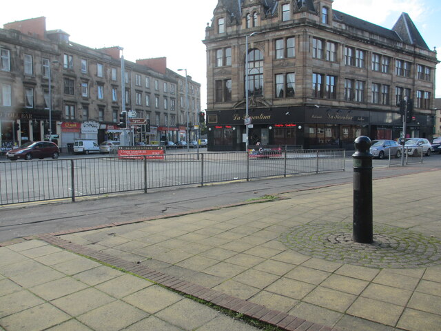
Image: © Diana Burns Taken: 12 Oct 2013
Surveyed by the Milestone Society. The post is at the Workspace Housing Site at the junction of Paisley Road West and Govan Road. It denotes the old turnpike roads from Glasgow to Greenock via Paisley and Govan. The premises on the extreme left are called 'The Toll Bar'.
Images are licensed for reuse under creativecommons.org/licenses/by-sa/2.0
Image Location
Latitude
55.853912
Longitude
-4.278619