Bridge over the Bishopbriggs Burn
Introduction
The photograph on this page of Bridge over the Bishopbriggs Burn by Richard Sutcliffe as part of the Geograph project.
The Geograph project started in 2005 with the aim of publishing, organising and preserving representative images for every square kilometre of Great Britain, Ireland and the Isle of Man.

There are currently over 7.5m images from over 14,400 individuals and you can help contribute to the project by visiting https://www.geograph.org.uk
Bridge over the Bishopbriggs Burn
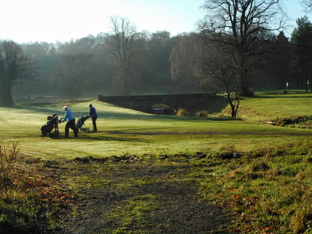
Image: © Richard Sutcliffe Taken: 28 Nov 2020
The 19th century bridge carries the main drive to Cawder House over the burn. It is Category C listed http://portal.historicenvironment.scot/designation/LB22275. It is now part of the Cawder Golf Club.
Images are licensed for reuse under creativecommons.org/licenses/by-sa/2.0
Image Location
Latitude
55.926339
Longitude
-4.225242