Milestone, A419
Introduction
The photograph on this page of Milestone, A419 by Mr Red as part of the Geograph project.
The Geograph project started in 2005 with the aim of publishing, organising and preserving representative images for every square kilometre of Great Britain, Ireland and the Isle of Man.

There are currently over 7.5m images from over 14,400 individuals and you can help contribute to the project by visiting https://www.geograph.org.uk
Milestone, A419
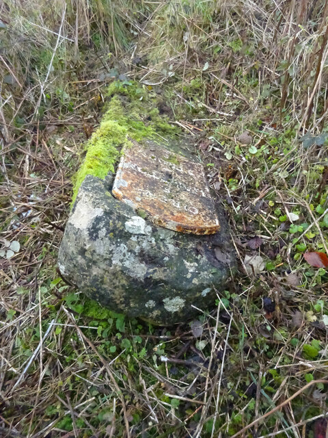
Image: © Mr Red Taken: 23 Nov 2020
Fallen over, a little East of Beacon Farm. Benchmark represents 187.9 m ASL (BM is cut at an angle, implying the stone was leaning backwards at the time) see - http://benchmarks.mister.red/#SO93110179 . In the civil parish of Sapperton. Cirenᴿ / 6 / Hampton / 4 / Stroud / 8 (Minchinhampton) Milestone Society National ID: GL_CISD06
Images are licensed for reuse under creativecommons.org/licenses/by-sa/2.0
Image Location
Latitude
51.714832
Longitude
-2.101027