Wayford - the Manor House, St Michael's Church and churchyard
Introduction
The photograph on this page of Wayford - the Manor House, St Michael's Church and churchyard by Sarah Smith as part of the Geograph project.
The Geograph project started in 2005 with the aim of publishing, organising and preserving representative images for every square kilometre of Great Britain, Ireland and the Isle of Man.

There are currently over 7.5m images from over 14,400 individuals and you can help contribute to the project by visiting https://www.geograph.org.uk
Wayford - the Manor House, St Michael's Church and churchyard
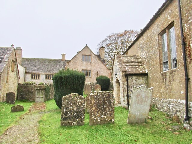
Image: © Sarah Smith Taken: 30 Oct 2020
The Manor House is Grade I listed. The Daubeney family acquired the manor in the 15C. The house was rebuilt in 1600 and has been altered and extended several times since then. The church was built in the 13C and is Grade II listed. It too has been altered and restored. The porch was added in 1602.
Images are licensed for reuse under creativecommons.org/licenses/by-sa/2.0
Image Location
Latitude
50.856015
Longitude
-2.847109