Direction Sign ? Signpost in Belton in Rutland
Introduction
The photograph on this page of Direction Sign ? Signpost in Belton in Rutland by O Rushby as part of the Geograph project.
The Geograph project started in 2005 with the aim of publishing, organising and preserving representative images for every square kilometre of Great Britain, Ireland and the Isle of Man.

There are currently over 7.5m images from over 14,400 individuals and you can help contribute to the project by visiting https://www.geograph.org.uk
Direction Sign ? Signpost in Belton in Rutland
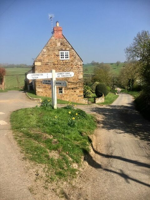
Image: © O Rushby Taken: 15 Nov 2020
Located in the centre of the junction of College Farm Lane, Lambley Lodge Lane, Chapel Street and Loddington Lane in Belton in Rutland parish. 4 arms and no finial. See also http://www.geograph.org.uk/photo/4952032. Milestone Society National ID: RU_SK8101A
Images are licensed for reuse under creativecommons.org/licenses/by-sa/2.0
Image Location
Latitude
52.604878
Longitude
-0.794738