Bury St Edmunds houses [146]
Introduction
The photograph on this page of Bury St Edmunds houses [146] by Michael Dibb as part of the Geograph project.
The Geograph project started in 2005 with the aim of publishing, organising and preserving representative images for every square kilometre of Great Britain, Ireland and the Isle of Man.

There are currently over 7.5m images from over 14,400 individuals and you can help contribute to the project by visiting https://www.geograph.org.uk
Bury St Edmunds houses [146]
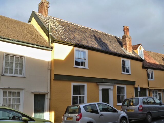
Image: © Michael Dibb Taken: 12 Sep 2020
Number 44 College Street, The Old Angel, was originallt two houses and later a public house. Both houses were built in the 16th century, timber framed and stuccoed, jettied along the street with part being underbuilt. At the rear are three gabled extensions and the house is divided by a carriage entrance cut through the end of both frames. Listed, grade II, with details at: https://historicengland.org.uk/listing/the-list/list-entry/1076946 College Street is one of the north-south streets within the medieval grid and is a continuation southward of Hatter Street, running from Churchgate Street to Westgate Street. Almost entirely residential but there is a Victorian school at the south end. Bury St Edmunds is a market town which is the cultural and retail centre for West Suffolk and is known for brewing (Greene King) and sugar (British Sugar). There is scattered evidence of earlier activity but essentially Bury St Edmunds began as one of the royal boroughs of the Saxons and a monastery was founded which became the burial place of King Edmund. A new Benedictine abbey was built in 1020 which became rich and powerful and the town was laid out on a grid pattern by Abbot Baldwin. After the dissolution the abbey became ruinous. A new church, later the cathedral, was begun in the early 16th century.
Images are licensed for reuse under creativecommons.org/licenses/by-sa/2.0
Image Location
Latitude
52.241861
Longitude
0.714631