Vaal Street, Hollinwood
Introduction
The photograph on this page of Vaal Street, Hollinwood by Chris Allen as part of the Geograph project.
The Geograph project started in 2005 with the aim of publishing, organising and preserving representative images for every square kilometre of Great Britain, Ireland and the Isle of Man.

There are currently over 7.5m images from over 14,400 individuals and you can help contribute to the project by visiting https://www.geograph.org.uk
Vaal Street, Hollinwood
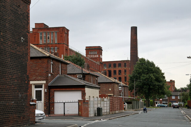
Image: © Chris Allen Taken: 6 Aug 2006
The streets in this area are named after Boer War locations and even the Mill is Durban Mill. The subject is centred on the tree that still survives and the street immediately to the left is Kimberley Street. In the distance the chimney belong to Brook No. 2 Mill that is seen either side of the tree. Both these mills have been demolished and there are new houses on the Durban Mill Site and the Oasis Academy on the Brook No. 2 Mill site.
Images are licensed for reuse under creativecommons.org/licenses/by-sa/2.0
Image Location
Latitude
53.524853
Longitude
-2.131041