Old Boundary Marker
Introduction
The photograph on this page of Old Boundary Marker by Mike Rayner as part of the Geograph project.
The Geograph project started in 2005 with the aim of publishing, organising and preserving representative images for every square kilometre of Great Britain, Ireland and the Isle of Man.

There are currently over 7.5m images from over 14,400 individuals and you can help contribute to the project by visiting https://www.geograph.org.uk
Old Boundary Marker
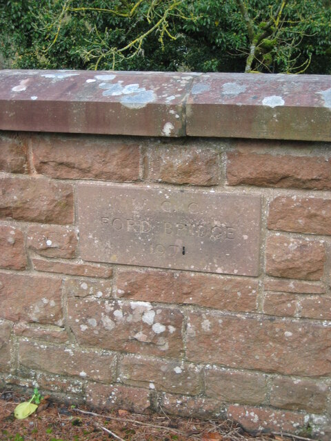
Image: © Mike Rayner Taken: 6 Nov 2020
Bridge Marker set in the northern bridge parapet of Ford Bridge, Augill Beck in Church Brough. Brough parish. Inscribed W C C / FORD BRIDGE / 1971. Milestone Society National ID: WE_BROUGH02br
Images are licensed for reuse under creativecommons.org/licenses/by-sa/2.0
Image Location
Latitude
54.522228
Longitude
-2.318885