Milepost at a National Cycle Network junction
Introduction
The photograph on this page of Milepost at a National Cycle Network junction by Robin Drayton as part of the Geograph project.
The Geograph project started in 2005 with the aim of publishing, organising and preserving representative images for every square kilometre of Great Britain, Ireland and the Isle of Man.

There are currently over 7.5m images from over 14,400 individuals and you can help contribute to the project by visiting https://www.geograph.org.uk
Milepost at a National Cycle Network junction
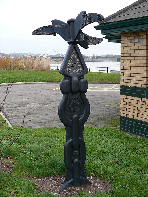
Image: © Robin Drayton Taken: 22 Jan 2008
To the left is Route 47 - Town Centre 2M, Newport Castle 1¾M. Upper right is Route 4 - Tredegar House 2½M, Caerphilly 15M. Lower right is Route 4 - Wetlands Reserve 3½M, Chepstow 23M. This route is via Image but if this is closed then the City Bridge which can be seen in the background is the alternative route.
Images are licensed for reuse under creativecommons.org/licenses/by-sa/2.0
Image Location
Latitude
51.571052
Longitude
-2.987168